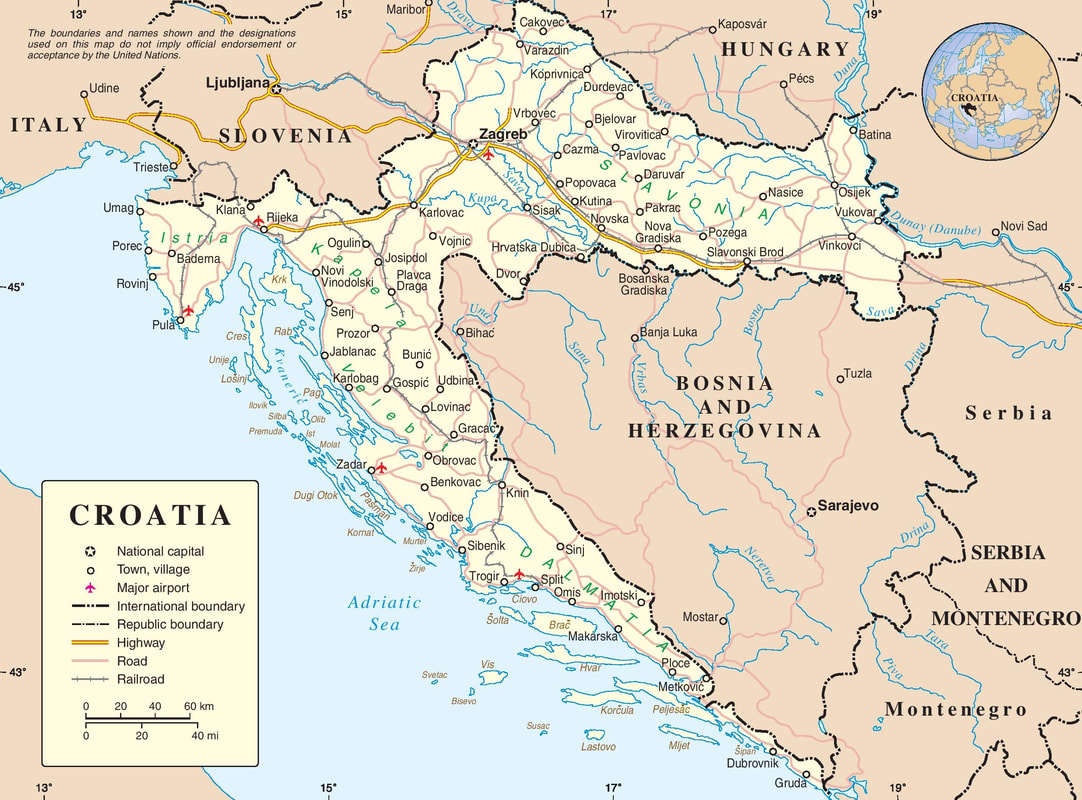
About Croatia: Republika Hrvatska #002Map of Croatia
Sometimes it is useful to be able to refer to a map of a country of interest - just to see where it is in relation to bordering countries, and to identify the relative positions of regions, towns, rivers, mountain ranges, and so on.
This post is motivated by the fact that I realised that I was unable to name correctly all of the countries bordering Croatia. There are all sorts of maps, each with different information. Let's start off with a map that shows the shape of Croatia, the countries that surround it, and 50 or 60 of its cities and largest towns.
Testing, testing .....
Map courtesy of the Centre for Resarch on Globalization, taken from
www.globalresearch.ca/history-of-pan-slavic-identity-and-unity-the-idea-of-a-greater-croatia-by-17th-century-publicist-pavao-ritter-vitezovic/5653021
Getting around
You can browse or search this website in the following ways:
AHA! Learning Croatian with Bob
Correspondence: [email protected]
0 Comments
|
